For our “Neighboring Faith Communities” class for middle schoolers, I continue to think about ways to communicate the incredible religious diversity in our area. My latest effort: a map that shows faith communities in South Palo Alto, an area roughly bounded by U.S. 101 on the northeast, Oregon Expressway on the northwest, El Camino Real on the southwest, and San Antonio Rd. on the southeast. (I did go a little past these arbitrary boundaries to include some additional faith communities.)
The map below shows the approximate boundaries of the area I researched, a rectangle about 2 miles by 2-1/2 miles. Our faith community, the Unitarian Universalist Church of Palo Alto (UUCPA), is circled in red. All the faith communities shown are within about a half hour’s walk of our congregation. You can click on this map to go to an interactive map on Mapquest (I’ve also embedded the Mapquest map at the very end of this post).
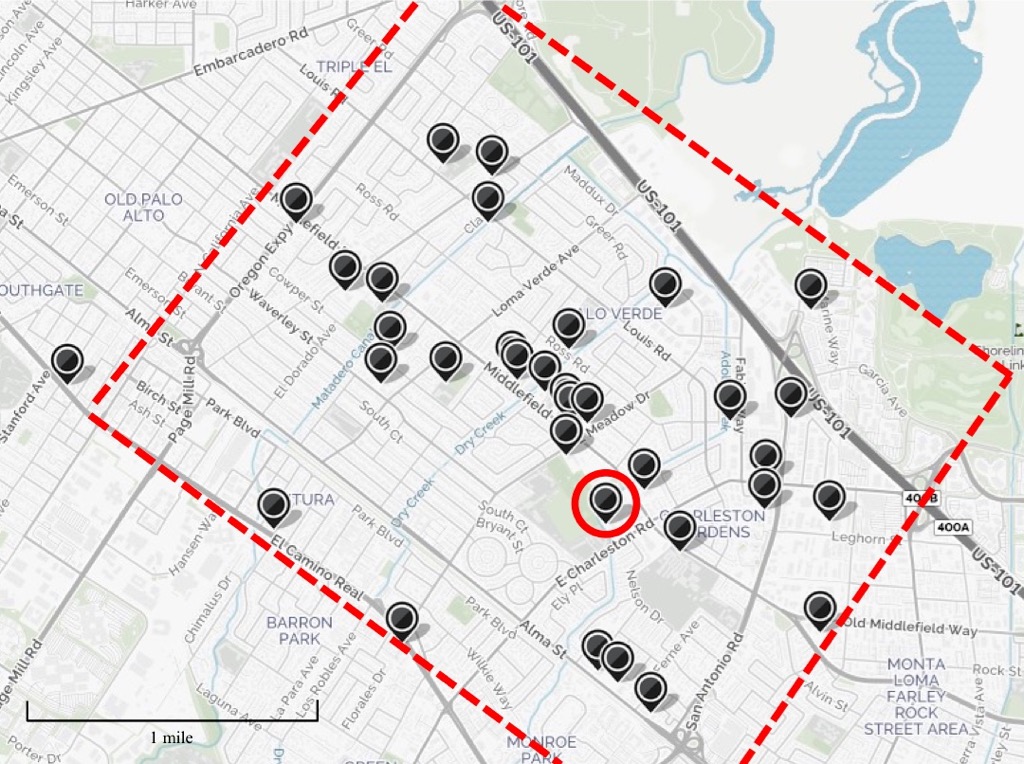
Below is the list of the 35 faith communities I found in this area. I suspect I missed some; if you can identify other faith communities in this area, please let me know about it in a comment. (Updated 10/20/16 based on Erp’s comment.) Continue reading “South Palo Alto faith communities”