We got a late start (again), so this will be a short post.
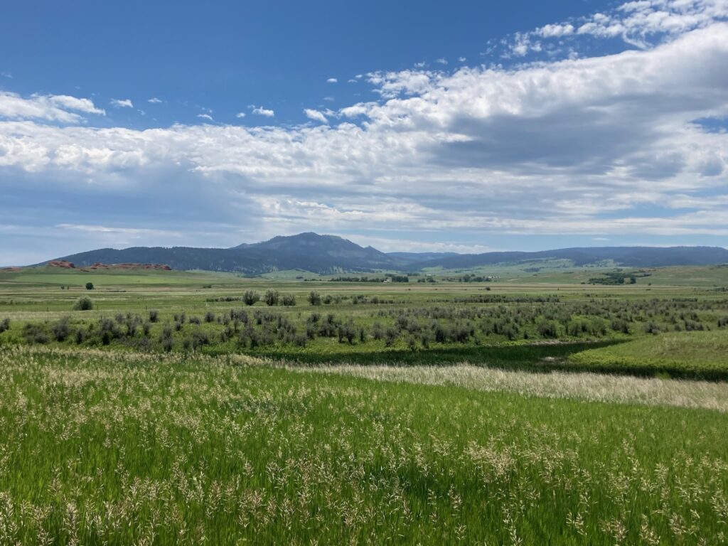
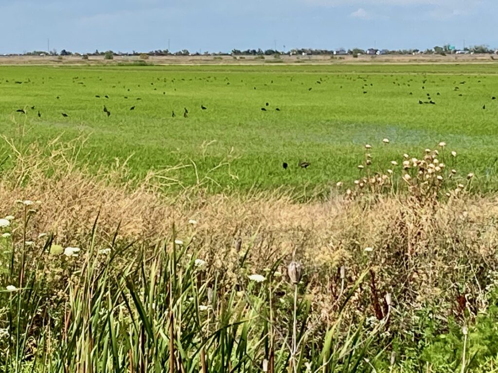
Heading east from Gillette, Wyo., we left the Far West behind and entered the Great Plains. It’s still spring, so the grasslands were brilliant green. As we entered the Black Hills of South Dakota, we saw how they got their name: in contrast to the grasslands, the hills covered with conifers appear black.
The Black Hills of South Dakota as seen across the grasslands
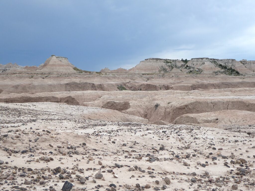
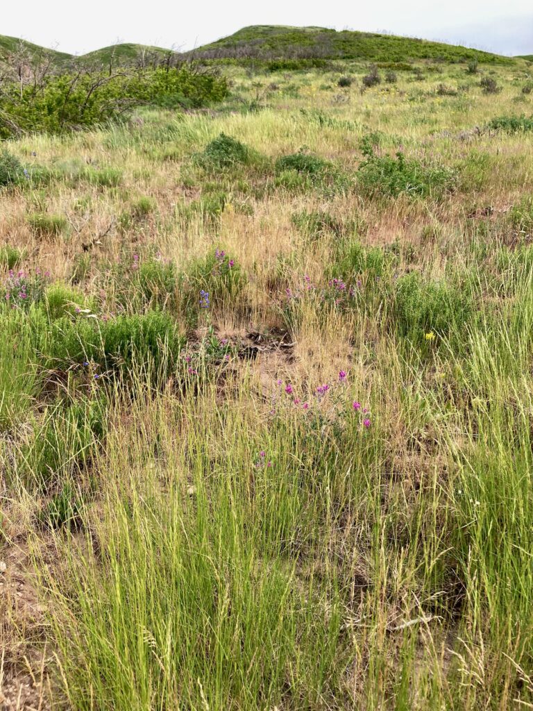
Carol asked a pleasant man at the visitor center just over the South Dakota border if there was anything we should see. He recommended the auto tour route through Badlands National Park. The more popular viewpoints were pretty crowded, with many overweight tourists. We decided to hike part of the Castle Trail. Within a half mile from the trailhead parking lot, there were no other people. It took an hour to go two miles, because I kept stopping to take photos of flowers (Plains Pricklypear, Sego Lily, several flowers in the legume family, etc.) and birds (Rock Wren, Say’s Phoebe, Red-winged Blackbird, etc.) and even a few photos of the dramatic landscape.
Along Castle Trail, Badlands National Park
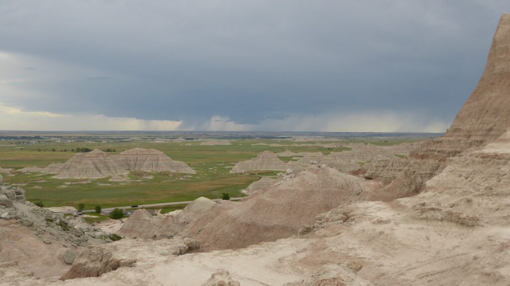
By the time we got to the Saddle Pass Trail, the sky was looking pretty dark. Lightning flashed in the distance.
Dark clouds from Saddle Pass
We headed back as quickly as we could; the return trip took a little less than half an hour. A few drops of rain starting falling as we got into our car.
Light rain continued most of the way from Badlands National Park to Chamberlain, S.D. And right now, the rain is coming down in buckets, pounding on the roof of the motel. “We got here just in time,” Carol just said. “It would not have been fun driving in that.”
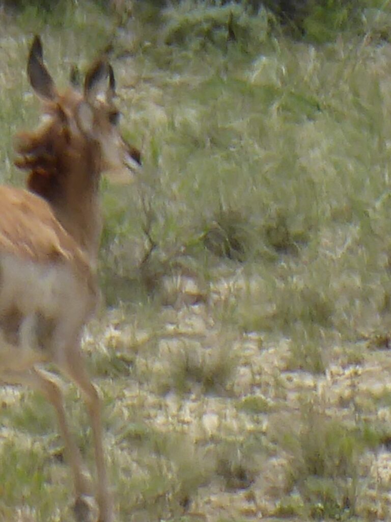
After driving for about 80 miles, I decided I needed to stretch my legs, so we took Exit 184, Continental Divide Road, and turned right onto a dirt road that led to some wayside markers. One of the signs explained how Henry Bourne had an idea for a cross-country auto road. But, as usual, I was looking at flowers, and I followed my gaze down a dry wash. By chance I looked up, and there was a Pronghorn Antelope staring at me. I got out my super-zoom camera in time to catch a blurry photo of the antelope running away from me.
Pronghorn Antelope running away
Our next stop was Rawlins. Carol wanted to go to the library there for an online meeting she had scheduled at two o’clock. We arrived early, and walked around the downtown. Carol stopped to admire a piano on the sidewalk that was painted with a Van Gogh design. A friendly woman came along and said, “Play something for us!” It turned out she was the economic development director for downtown Rawlins, and she told us about some of the city’s accomplishments. I noticed that she often spoke about involving children and teens in city projects, and asked if she used Search Institute’s Developmental Assets model for supporting the healthy development of children and teens. She said that she did indeed use that model.
After Carol’s meeting was over, we headed to Gillette. While Carol drove, I got out my laptop and worked on a PowerPoint presentation that was due today. The slide deck was hosted on Google Drive, so I used my phone as a hotspot as we drove across the high plains of Wyoming. Working remotely has become so easy that you can do it on a cross-country trip. I’m not sure this is a good thing.
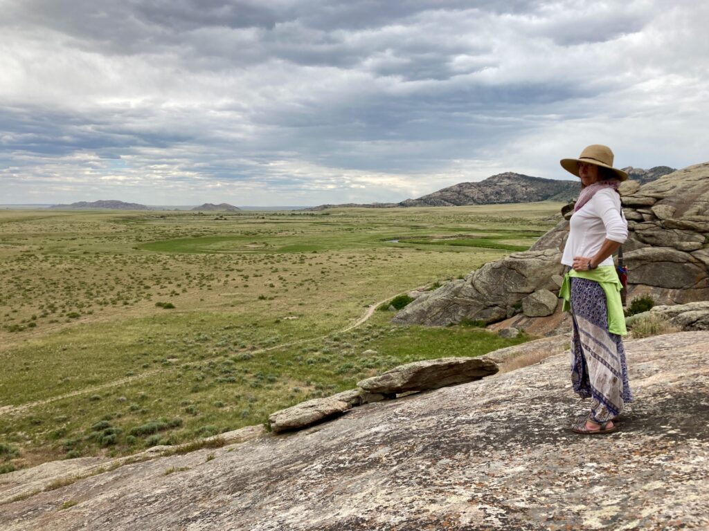
We stopped at Independence Rock Historic Site. Independence Rock is a huge outcropping of granite that served as a landmark for the Oregon Trail. We walked around the base — me looking for flowers as usual — and then we climbed partway up the rock.
Carol on Independence Rock
It was so windy that we decided not to climb to the top of the rock. We walked all the way around Independence Rock, and as every tourist does we admired the nineteenth century grafitti scratched into it.
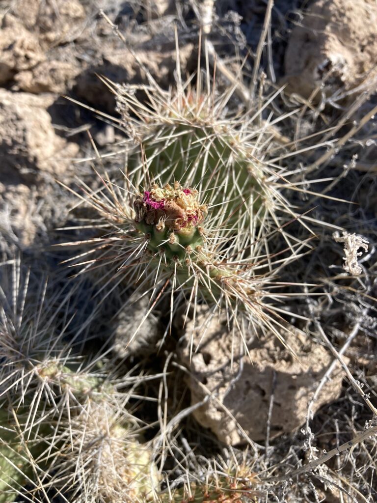
But for me, the highlight of our stop at Independence Rock was seeing a Plain Pricklypear (Opuntia polyacantha) in full bloom.
Opuntia polyacantha in bloom
We arrived in Gillette after dark. We’re both pretty tired. It’s time for bed.
(Random facts from today’s trip: We crossed the continental divide three times today. The highest point of our trip was when we crossed the continental divide on U.S. Highway 237, at an elevation of 7,174 feet above sea level. Our gas mileage for the second half of the day was over 36 miles per gallon, even with the canoe on the car — this afternoon’s gas mileage was higher than usual because we were driving downhill from the continental divide.)
Our room in Wendover looked out onto a rock outcropping which rose up a hundred feet or more behind the motel. After a quick breakfast, I went out and followed an ATV trail up the outcropping. Soon I was fifty feet above the motel, on a level area below the summit of the outcropping. From there I could see the Union Pacific rail lines heading east. A long train squealed slowly around a loop of rail, heading towards the main line. The main line was a straight line across miles of white salt flats, paralleling the interstate highway, both disappearing into the distance. I spent a quarter of an hour on the level area looking at the desert plants there — ephedra (Ephedra sp.), with no leaves to speak of, just stems with chlorophyll; prickly-pear cactus (Opuntia sp.), with a red blossom just gone by; saltbush; sagebrush (Artemisia sp.); and so on. Once again on this trip, I spent far more time looking at the world at my feet, rather than looking up at the awe-inspiring landscape around me.
Prickly-pear cactus (Opuntia sp.)
We stopped in Salt Lake City to meet Sandy, an old friend of Carol’s, for lunch. I was fascinated to hear them reminiscing about their days in middle school and high school: the hierarchies of their schools; the track coach who years later would be arrested for molesting his step-daughter; a favorite English teacher, Miss Mountford; the differences between their two families; and so on. I felt they both must have been nice teenagers.
I was especially interested to hear that Sandy serves as a translator for her church’s worship services. She’s fluent in Spanish, so she can translate for English speakers when the sermon is in Spanish. I asked her about the mechanics of translating the sermon, and she said she’s in a sound-proof booth, speaking into a microphone; those who need or want the translation wear an earpiece to listen to her. Maybe someday some of our Unitarian Universalist congregations will be able to do something like that.
I drove as we left Salt Lake. Carol dislikes twisty mountain roads, and the road from Utah into Wyoming is definitely a twisty mountain road. We pulled over at a rest stop at about mile 170 on I-80 for a mid-afternoon snack. There were picnic tables up a steep paved sidewalk, and up another even steeper paved sidewalk was an observation platform. Behind the rest area, a plain dotted with sagebrush sloped up to peaks above.
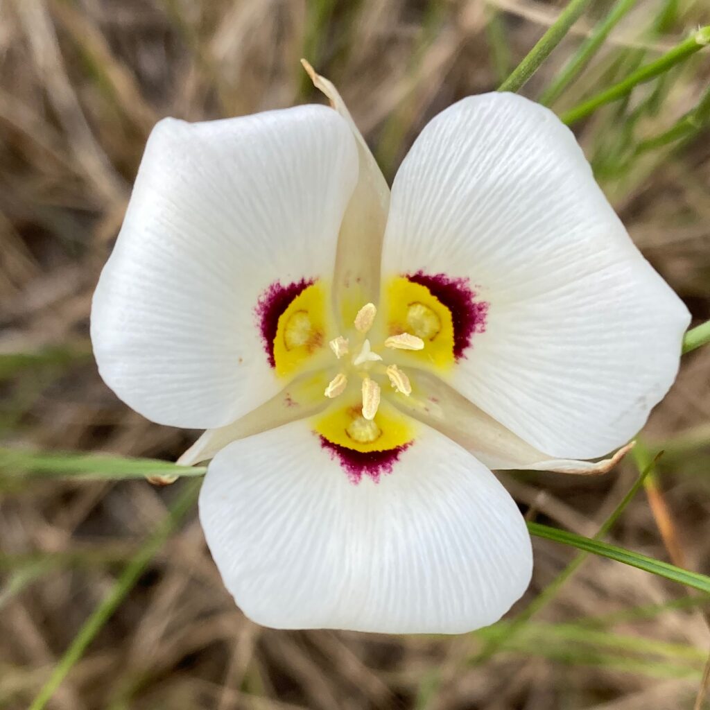
A sign on a fence said that this land was a wildlife management area. I walked through the fence, and out onto that sagebrush-dotted slope. There were flowers everywhere. I spent a happy half hour looking at flowers and taking photographs, until my cell phone rang. It was Carol asking where I was. “You don’t have to hurry back,” she said, “I just wanted to know where you were.” I took her at her word, and spent another quarter of an hour looking at flowers. My favorite was the Sego Lily: three white petals marked with yellow and deep red at their bases, over three cream colored sepals.
Sego Lily (Calochortus nuttallii)
When we got to Rock Springs, we followed the signs to the “Historic Downtown” area, parked the car, and walked around. We saw some people cooking something outdoors. “Want to go over?” Carol said. At first I said no, but I realized I was hungry, so then I said yes. A talkative woman greeted us, and pointed to a whiteboard with the menu: hot dogs, Kronski’s, and funnel cakes. We asked what “Kronski’s” were, and the woman told us that they were sausages that were made here in Rock City, in fact they were made in the building that we were all standing in front of.
I ordered a Kronski, and Carol ordered a hot dog. A man — who, as it turned out, was the woman’s brother — cooked the sausage and hot dog for us, and the woman gestured to the tray of condiments. We both put sauerkraut on our meat. The man invited us to sit at some tables behind him, and offered to turn off the Ozzy Osborne he’d been listening to, but we said we liked Ozzy. We had a long chat with the two of them. They had just started out this new business, and were trying to figure out how to make it work.
When we finished eating, we thanked them, and finished our walk around the historic district. It was getting dark, so then we drove back to the motel.
We drove past dramatic scenery today: the Forty-Mile Desert, the green Humboldt River valley in between sagebrush plains, towering 11,000 foot mountains…. But what stays in my mind are the flowers we saw blooming near Pequop Summit.
We parked in the Pequop Summit rest area, elevation 6,967 feet above sea level. We walked over the cattle guard to a dirt road cut into the side of the hill, and then I saw a flower up a fairly steep embankment. I scrambled up to look at it. There was a small Single-leaf Pinyon Pine (Pinus monophylla) just beyond it, then a pale yellow Paintbrush (Castilleja sp.) above that, and then some purple Hooker’s Onions (Alium acuminatum) above that. “Be careful coming down,” said Carol from the dirt road twenty feet below me. I decided that going up was easier than trying to slide down, so I scrambled up to the top of road cut. By now, I was more than thirty feet above the highway, so I must have been over seven thousand feet.
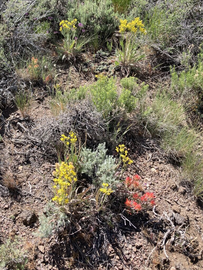
It was beautiful up there. At seven thousand feet above sea level, it was still springtime. Flowers were blooming everywhere. In some places you couldn’t move without stepping on a flower. In among the pungent-smelling sagebrush (Artemisia sp.), sprightly yellow Groundsels (Packera sp.), like tiny little yellow daisies, grew next to low-growing Lava Asters (?) (Ionactis alpina). The Mule’s Ears (Wyethia sp.), with their leaves like the ears of mules and their flowers like little sunflowers, were mostly past their prime, but in the shade of some big sagebrush bushes a few sheltered plants were still in full bloom.
The yellow flowers are Hawksbeard (Crepis sp.), the red ones are Paintbrushes (Castilleja sp.), and the small purple ones are Hooker’s Onion (Allium acuminatum)
In addition to the flowers, small grasshoppers were buzzing and jumping all through the scrubby growth. Birds sang throughout the sagebrush, and as I approached them were apparently surprised that a human was walking through their territories.
All this was happening within sight and sound of Interstate 80. Most of this was happening below the level of my waist. I was so fascinated by the sights, sounds, and smells that I never even looked up to admire the view from Pequop Summit, if there was indeed a view.
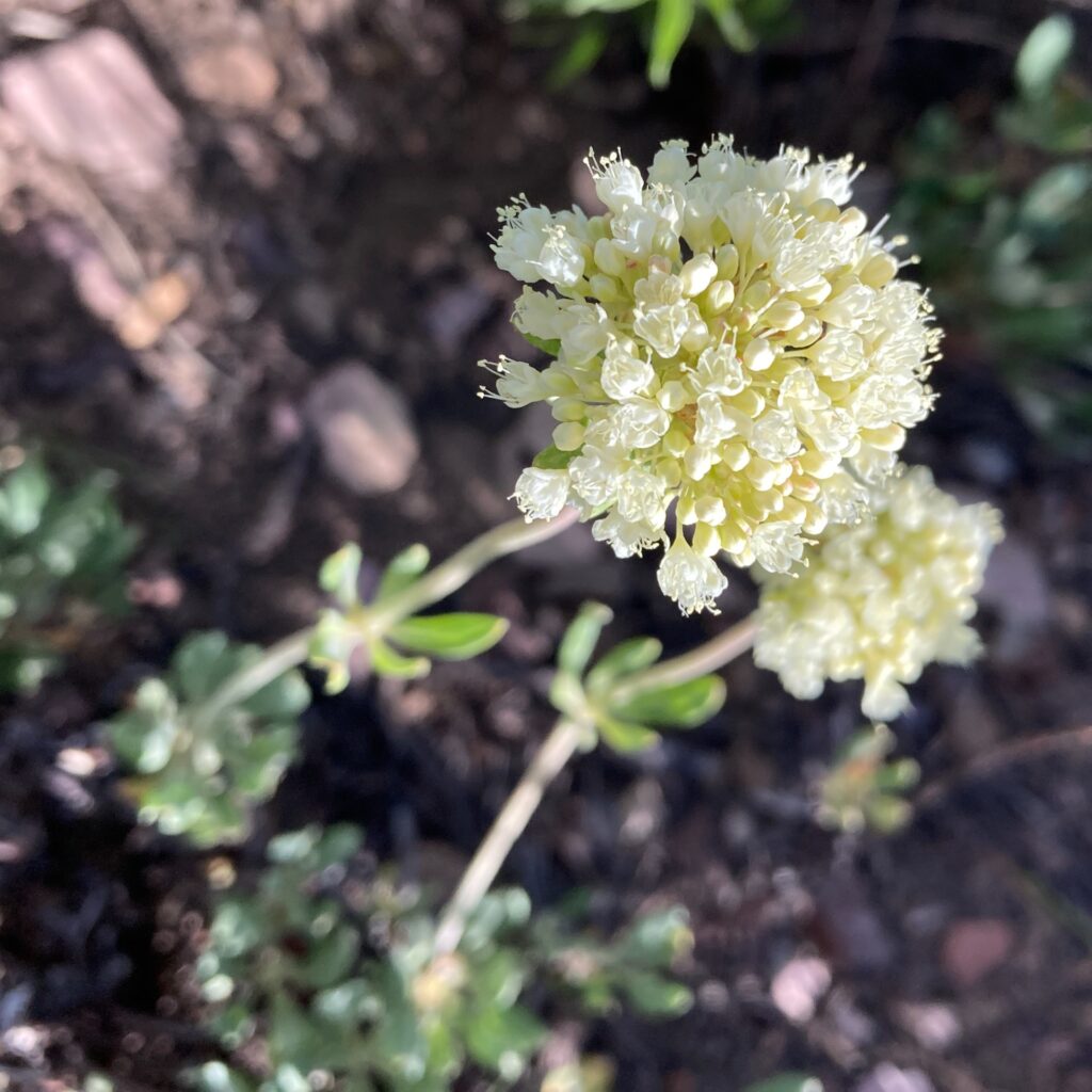
Eriogonum sp.
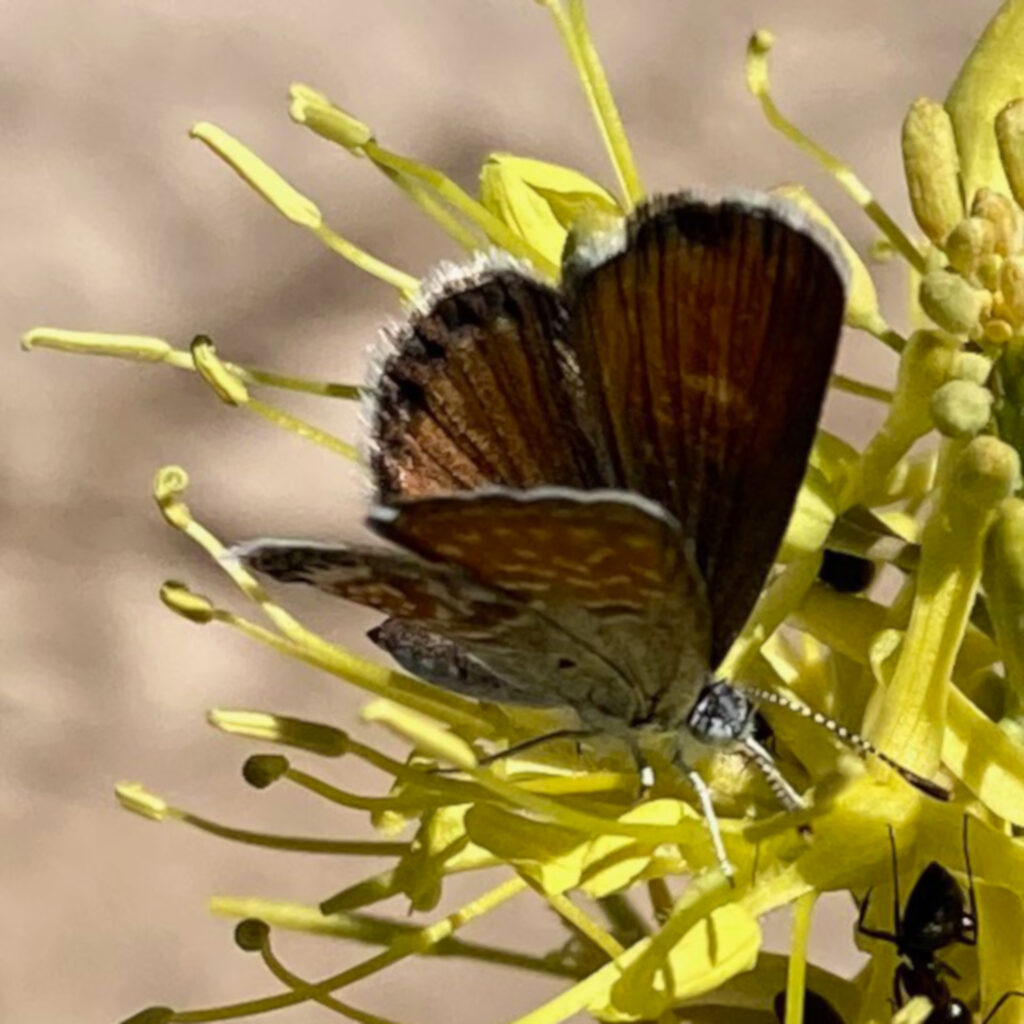
Earlier in the day, we had stopped for a rest break near Oreana, Nev. This was at a much lower elevation, and I didn’t expect to find any flowers in bloom. But I walked a little way down a dry wash, and there found two or three clumps of Desert Prince’s Plume (Stanleya pinnata) blooming. Pollinators swarmed around these flowers, including a Western Pygmy Blue butterfly.
Western Pygmy Blue (Brephidium exilis)
In Oreana as at Pequop Summit, I barely noticed the grand landscape scenery around me: my attention was on the small, intimate landscape at my feet.
We got up early, and kept working from six thirty to twelve thirty. We put a few last items in the moving container, tied the canoe on the car, did some more last minute cleaning, loaded up the car, argued about little things, did a walk-through of the house with Kathy the cemetery superintendent and Joe from the cemetery’s board of trustees. The truck came by at about 9:30 to pick up the moving containers — what a relief that was. The car was packed by noon. It was a “Spare the Air” day, and the smog was unpleasant. We were ready to go.
Thank goodness it was a holiday, the new federal holiday to commemorate Juneteenth. A holiday reduced the traffic from intensely unpleasant to merely horrible. We drove out through the inner Coast Range and into the Central Valley. We stopped at Dixon Fruit Stand, but they had mediocre fruit and durly clerks. We kept driving. Just past Davis, I said, “Let’s get off at Yolo Bypass.” “Where?” said Carol. “Right here, this exit,” I said. Carol zipped off the freeway at the last minute, saying she was willing to do something I wanted to do; meaning I should be nice to her when there was something she wanted to do later in the trip.
We drove to Parking Lot B, three quarters of a mile into Yolo Bypass Wildlife Management Area. Carol stayed in the car to take care of some business on her phone. I got out into the Central Valley heat, into the intense sunlight. I walked down a road. Yellow Star Thistle (Centaurea solstitialis) lined the road, but just a yard or two from the road, there was a band of tall Bisnaga (Visnaga daucoides), the white umbrels of flowers waving above the feathery green foliage. Beyond that, bulrushes (Schoenoplectus sp.?) grew where the road dropped off into marshlands. Off to my right, green rice fields stretched into the distance. A large flock of White-faced Ibis circled overhead, then settled into the rice fields.
White-faced Ibis in a rice field, Yolo Bypass Wildlife Management Area
After this stop, I felt different. I felt sane. Packing up and emptying out the house had felt strange, not completely moored in reality. The first two hours driving in the car still felt a little detached from reality. But the brilliant sunlight, the flowers, the pollinators, the birds, the jackrabbit loping lazily across the road — it felt like I was reconnecting with reality.
While I was photographing a flower, a man pulled up in his car, and spoke through the open window. “Um, I was just curious what you’re doing there. Not that you have to tell me, but…”
“Do you know this social media app iNaturalist?” I said. He didn’t. I explained that you could take a photo of a plant or animal, upload it, and get an identification. “I got into flowers recently,” I said, “and that’s how I’m learning them.” He asked me a few questions, then got ready to move on. “I’m Thomas, by the way,” he said. I introduced myself, then he drove off.
I walked slowly back to the car. Carol got out to take a short walk with me, but we agreed it was too hot, so we started riving again.
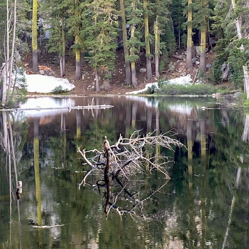
We stopped again at the Donner Pass rest area, and walked the little half mile loop next to the parking lot. It was already summer in the Central Valley, but it was still spring in the High Sierras. I saw a manzanita (Arctostaphylos sp.) still in bloom. We came to a small pond, and on the opposite shore there was still some unmelted snow.
Unmelted snow near Donner Pass
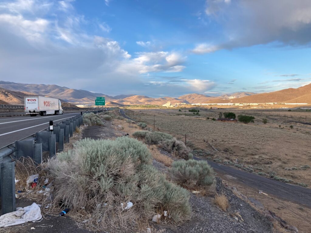
Then down the eastern slope of the Sierras into Nevada. Now we were in the dramatic landscape of the Great Basin. I noticed the canoe on top of the car cast an odd shadow as we drove.
Near Reno, on I-80
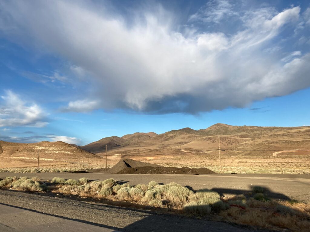
As sublime and awe-inspiring as the landscape was, it had been permanently marked by humankind. The philosopher Martin Heidegger, Nazi sympathizer though he was, had a useful insight with his concept of “Enframing”: part of the logic of modern human technology is to exclude all other ways of thinking about the world.
Patrick, Nev.
That sublime Nevada landscape is completely surveyed, marked out with roads and power lines, dotted with trash and effluvia; the habitats of plants and territories of birds must fit into the interstices of that human framework.
We drove on under the awe-full evening sky, and checked into our motel in Fernley, Nev.
The day before a road trip is usually busy. When you’re taking a road trip to move across the continent, the day before a road trip is especially busy.
Tomorrow we start driving to Massachusetts. We spent the day packing up the last of our belongings into moving containers. In the morning, we felt a bit frantic thinking of all we had to do today. Fortunately, Nancy and van came over to help out. They also brought food and, best of all, conversation. We had a pretty cheerful day.
While I was packing the moving container, half a dozen neighbors stopped by to ask us where we were moving to. Two of those neighbors were people I had never seen before. We’ve had a hard time meeting people in the neighborhood; I guess we should have moved out sooner, we would have met more people.
We face a busy day tomorrow. I’m going to crawl into bed — no, I take that back, I’m going to crawl into my sleeping bag. I’m so tired I’ll probably fall asleep immediately, even though I will be sleeping on the floor.
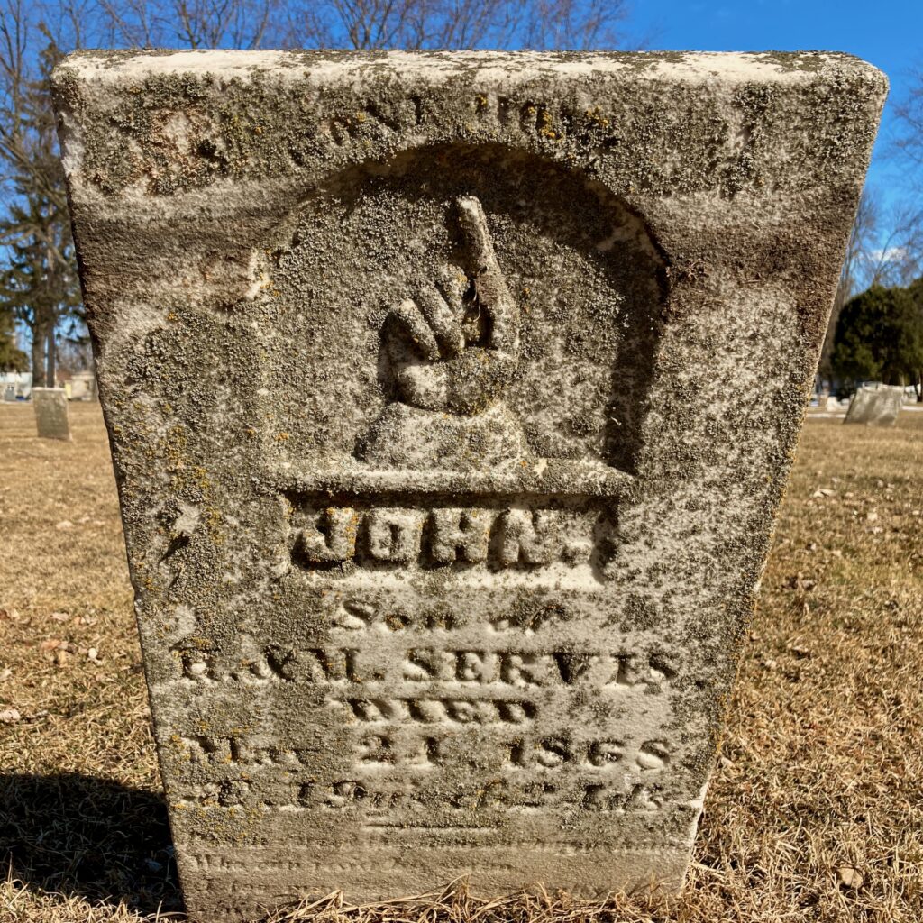
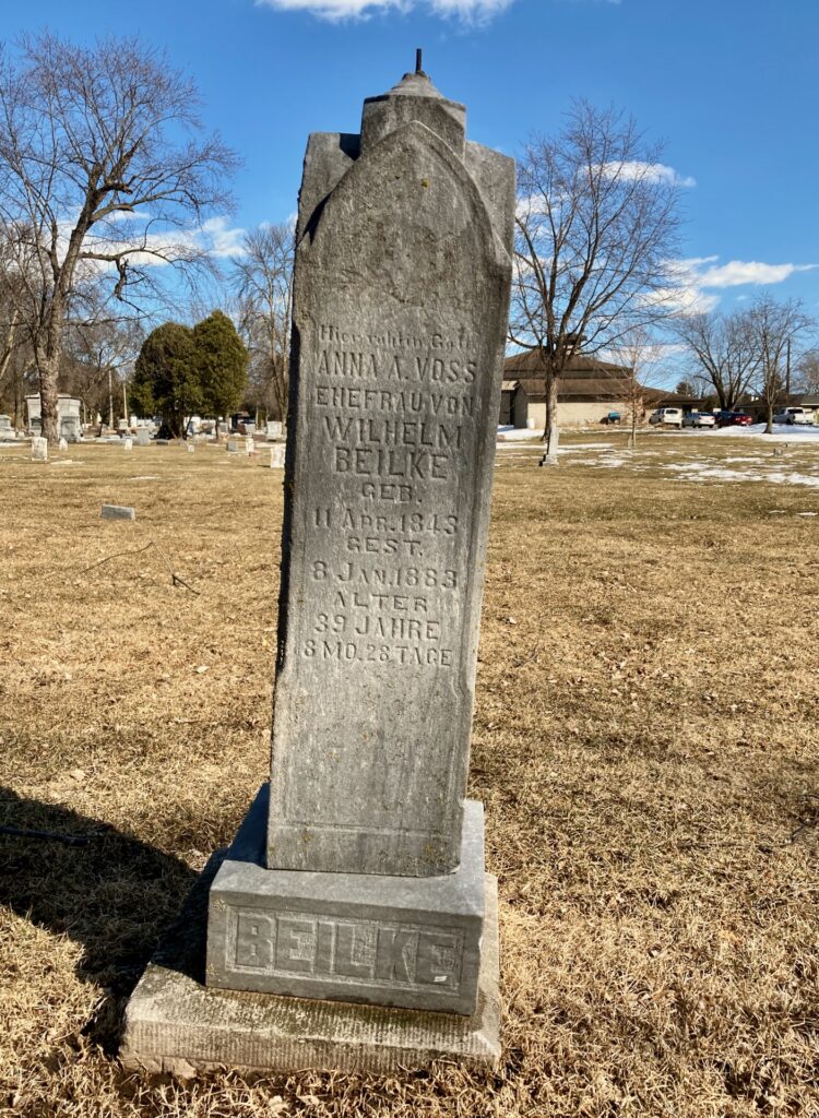
After last night’s snow storm, temperatures rose above forty degrees. This afternoon, Carol and I took a long walk. We wound up in Riverside Cemetery, where we were especially interested in the nineteenth century gravestones.
The gravestone reads: “John / Son of / H. & M. Serves, / died / May 21, 1868 / AE 19 yrs & 2 wks [?]” The lower lines were illegible.Grave marker, with inscription in German
I’ve been at a religious education conference for most of a week now. It has been very nice to be able to talk with colleagues in person, face-to-face. But it’s also exhausting. I talk with people for an hour over breakfast, then teach a class where we spend a lot of time talking, then talk for an hour over lunch, and often for another hour after lunch — and then I’m ready for a two-hour nap.
Others at the conference are having similar experiences. It’s really good to be able to be in a big group of people for the first time since March, 2020, but it’s also really tiring.
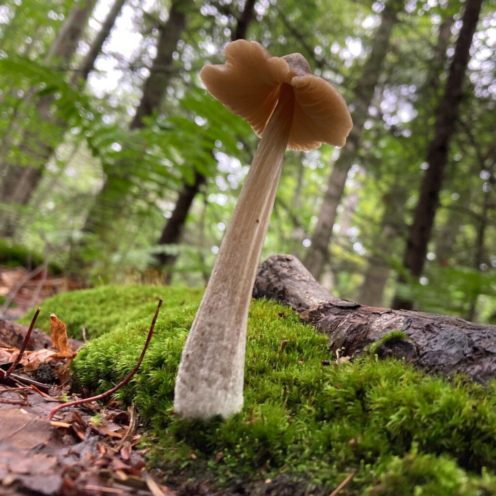
I’m at a religious education conference at Ferry Beach Conference Center in coastal Maine. They’ve had quite a bit of rain in the past month, and not surprisingly quite a few mushrooms have spring up — like this one:
So we’re still stuck in lockdown, and maybe you’re getting bored with your daily walks. The British Pilgrimage Trust has a suggestion: turn your walks into mini-pilgrimages. Their Web site has a list of “holy places” in the U.K. that you can walk to. Next you set a spiritual “intention,” then treat your walk as a kind of “focused meditation.” In an interview with Religion News Service, Guy Hayward, director of the Pilgrimage Trust, says more about those “intentions”:
“Pilgrimage is about traveling, about being a stranger in a strange land, according to [Hayward]. The pandemic flips that on its head. ” ‘Staying still is actually even more of a strange experience,’ he said. ‘It’s like, how do you make yourself be a stranger in a place you know really, really well? How do you make yourself see it fresh and see it in a new way?’ “
This, by the way, sounds a lot like Henry Thoreau’s essay on “Walking.”
For us Unitarian Universalists, what might constitute a “holy place” to which we might make a micro-pilgrimage? Back when we lived in downtown San Mateo, I would walk to different houses of worship. As is true of many small American cities these days, San Mateo has quite a diversity of faith communities, so from our old apartment I could walk to a Hindu temple, an Islamic masjid, a couple of historically Black churches, a Pure Land Buddhist Temple, a UCC church, a Catholic church, a Pentecostal storefront church, and several other places of worship. I’d think about — maybe I should say, do “focused meditation” on — the religious diversity of the world, and my place in that diversity. It proved to be both uplifting (“A masjid? how cool is that!”) and humbling (“Gee, Unitarian Universalism is not as important in the world as I’d like to believe”).
Now I live next to a cemetery. Walking in cemeteries was something of a tradition in New England, in part because they plow the roads in cemeteries in winter so it’s one of the few places you can walk safely without skis or snowshoes. But it was also a meditative practice: you’d read the inscriptions and wonder about the person who had died. This is another exercise in humility, and a lesson in perspective. How well am I living my life now, knowing that I’m as mortal as that person lying under the gravestone? But perhaps you have to be from New England, with that grim New England worldview, to appreciate this kind of micro-pilgrimage.
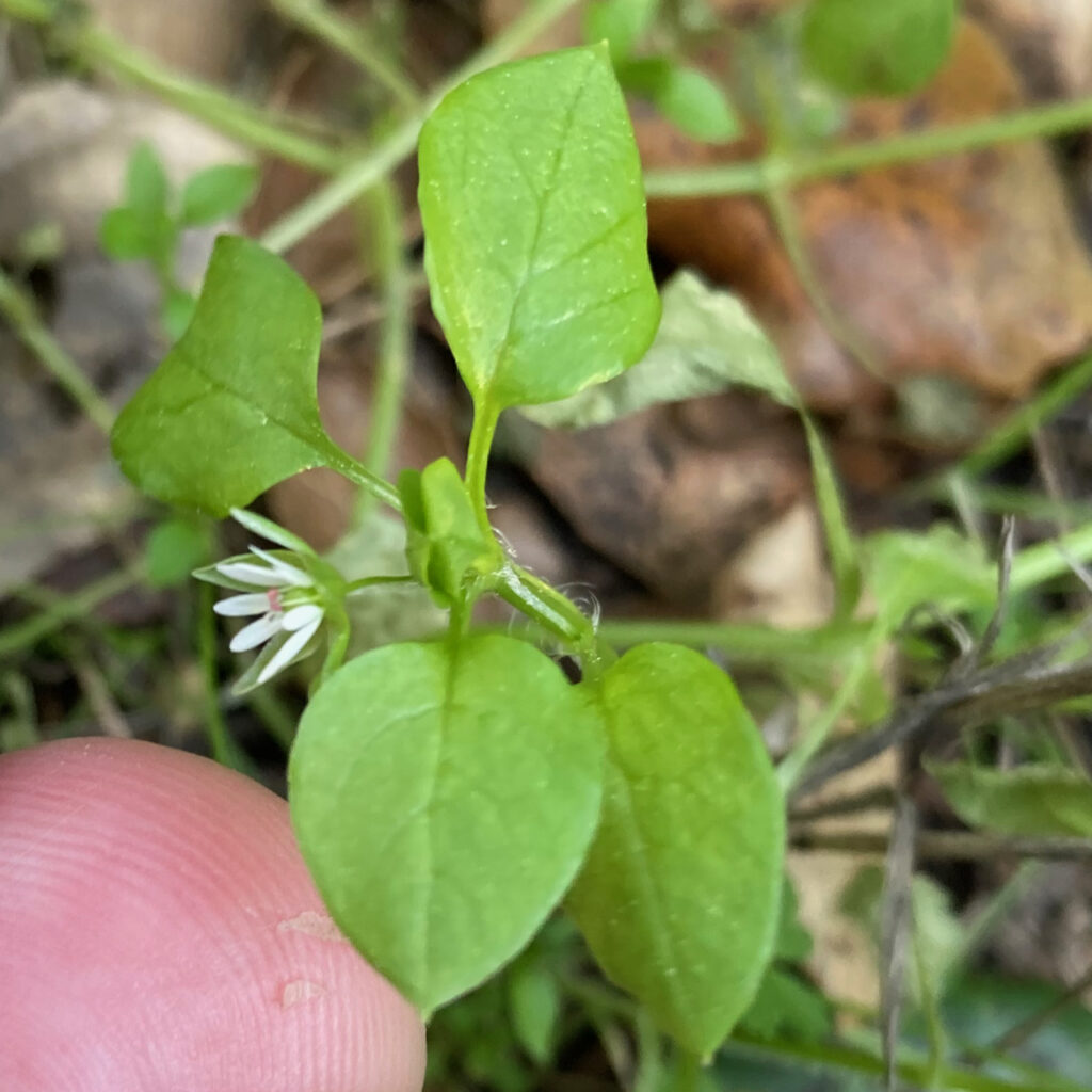
You can also follow Thoreau’s lead, and look at the world of nature around you. Even when you live in the city, or in the inner suburbs, places where humans utterly dominate the landscape, there are still plenty of non-human organisms worthy of human attention. Recently, I find myself looking for flowering weeds, like this chickweed:
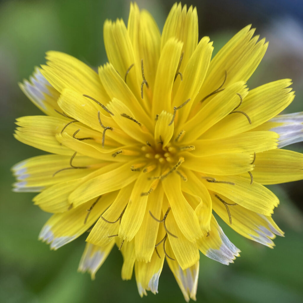
Or this flower, which is not a dandelion, but a related flower from the Cichorieae tribe (probably a Sow Thistle):
Why do I look for weeds? Maybe because of the same sentiment that Malvina Reynolds expressed in her song, “God Bless the Grass”:
God bless the grass that grows through the crack, They roll the concrete over it to try and keep it back…. God bless the truth that fights toward the sun, They roll the lies over it, and think that it is done….
The real point in all this is that any walk, even a walk around your neighborhood, can become more than just a walk. It can become a spiritual journey, where even though you stay in your neighborhood, you travel very far in spirit.