San Mateo to Fernley, Nev.

We got up early, and kept working from six thirty to twelve thirty. We put a few last items in the moving container, tied the canoe on the car, did some more last minute cleaning, loaded up the car, argued about little things, did a walk-through of the house with Kathy the cemetery superintendent and Joe from the cemetery’s board of trustees. The truck came by at about 9:30 to pick up the moving containers — what a relief that was. The car was packed by noon. It was a “Spare the Air” day, and the smog was unpleasant. We were ready to go.

Thank goodness it was a holiday, the new federal holiday to commemorate Juneteenth. A holiday reduced the traffic from intensely unpleasant to merely horrible. We drove out through the inner Coast Range and into the Central Valley. We stopped at Dixon Fruit Stand, but they had mediocre fruit and durly clerks. We kept driving. Just past Davis, I said, “Let’s get off at Yolo Bypass.” “Where?” said Carol. “Right here, this exit,” I said. Carol zipped off the freeway at the last minute, saying she was willing to do something I wanted to do; meaning I should be nice to her when there was something she wanted to do later in the trip.

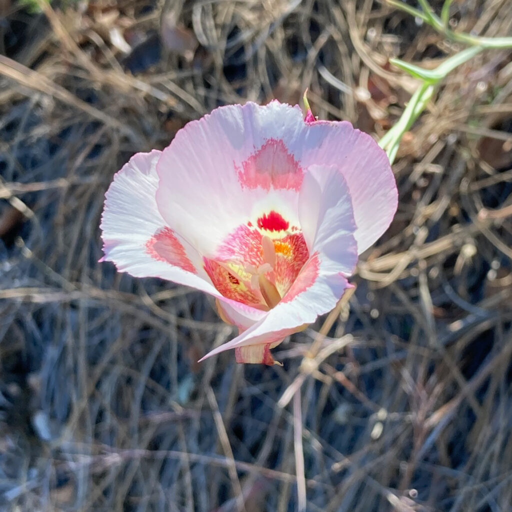
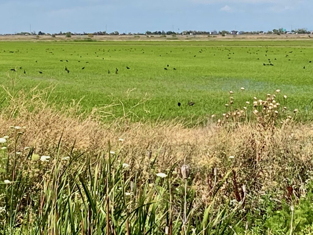
We drove to Parking Lot B, three quarters of a mile into Yolo Bypass Wildlife Management Area. Carol stayed in the car to take care of some business on her phone. I got out into the Central Valley heat, into the intense sunlight. I walked down a road. Yellow Star Thistle (Centaurea solstitialis) lined the road, but just a yard or two from the road, there was a band of tall Bisnaga (Visnaga daucoides), the white umbrels of flowers waving above the feathery green foliage. Beyond that, bulrushes (Schoenoplectus sp.?) grew where the road dropped off into marshlands. Off to my right, green rice fields stretched into the distance. A large flock of White-faced Ibis circled overhead, then settled into the rice fields.

White-faced Ibis in a rice field, Yolo Bypass Wildlife Management Area

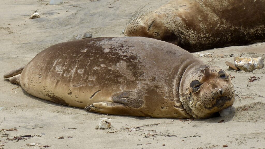
After this stop, I felt different. I felt sane. Packing up and emptying out the house had felt strange, not completely moored in reality. The first two hours driving in the car still felt a little detached from reality. But the brilliant sunlight, the flowers, the pollinators, the birds, the jackrabbit loping lazily across the road — it felt like I was reconnecting with reality.

While I was photographing a flower, a man pulled up in his car, and spoke through the open window. “Um, I was just curious what you’re doing there. Not that you have to tell me, but…”

“Do you know this social media app iNaturalist?” I said. He didn’t. I explained that you could take a photo of a plant or animal, upload it, and get an identification. “I got into flowers recently,” I said, “and that’s how I’m learning them.” He asked me a few questions, then got ready to move on. “I’m Thomas, by the way,” he said. I introduced myself, then he drove off.

I walked slowly back to the car. Carol got out to take a short walk with me, but we agreed it was too hot, so we started riving again.

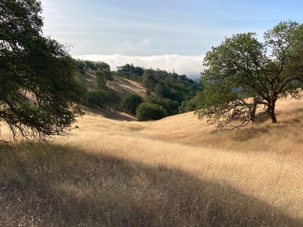
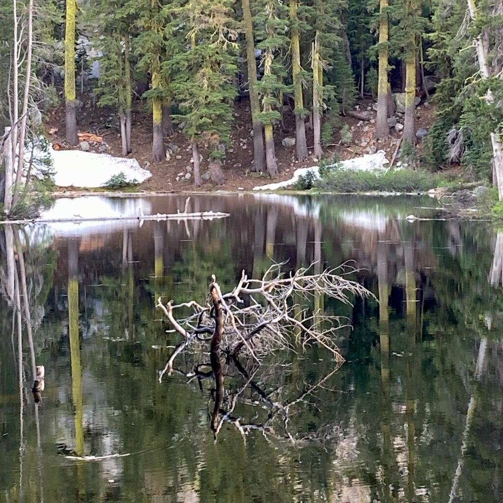
We stopped again at the Donner Pass rest area, and walked the little half mile loop next to the parking lot. It was already summer in the Central Valley, but it was still spring in the High Sierras. I saw a manzanita (Arctostaphylos sp.) still in bloom. We came to a small pond, and on the opposite shore there was still some unmelted snow.

Unmelted snow near Donner Pass

Then down the eastern slope of the Sierras into Nevada. Now we were in the dramatic landscape of the Great Basin. I noticed the canoe on top of the car cast an odd shadow as we drove.

Near Reno, on I-80

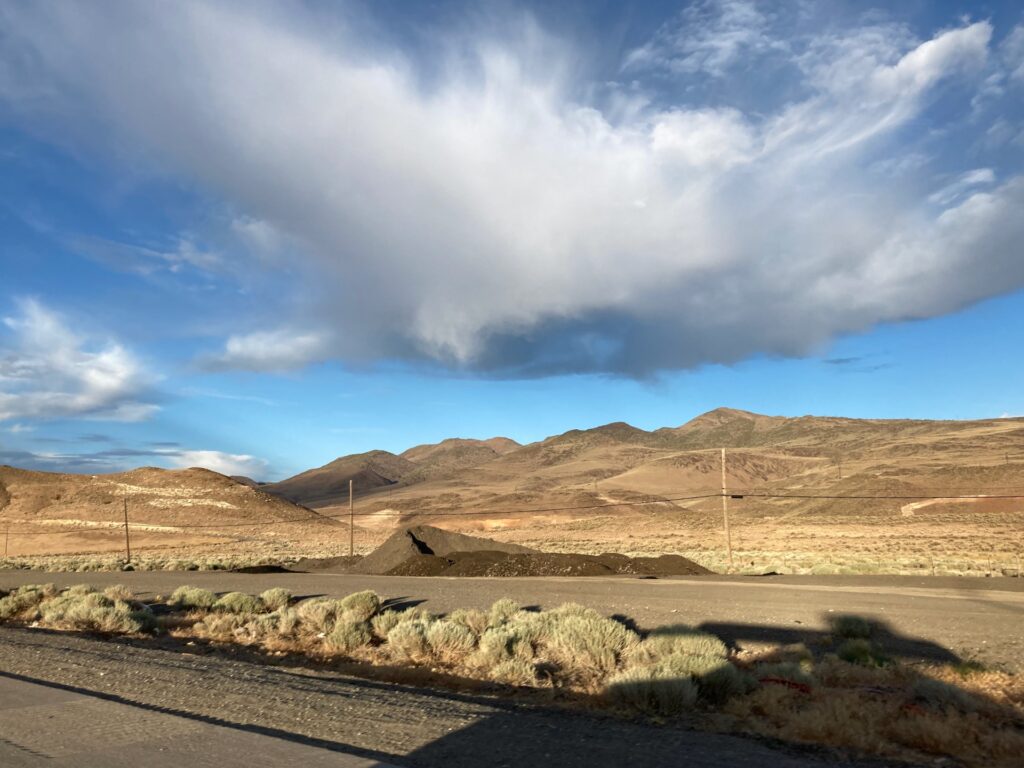
As sublime and awe-inspiring as the landscape was, it had been permanently marked by humankind. The philosopher Martin Heidegger, Nazi sympathizer though he was, had a useful insight with his concept of “Enframing”: part of the logic of modern human technology is to exclude all other ways of thinking about the world.

Patrick, Nev.

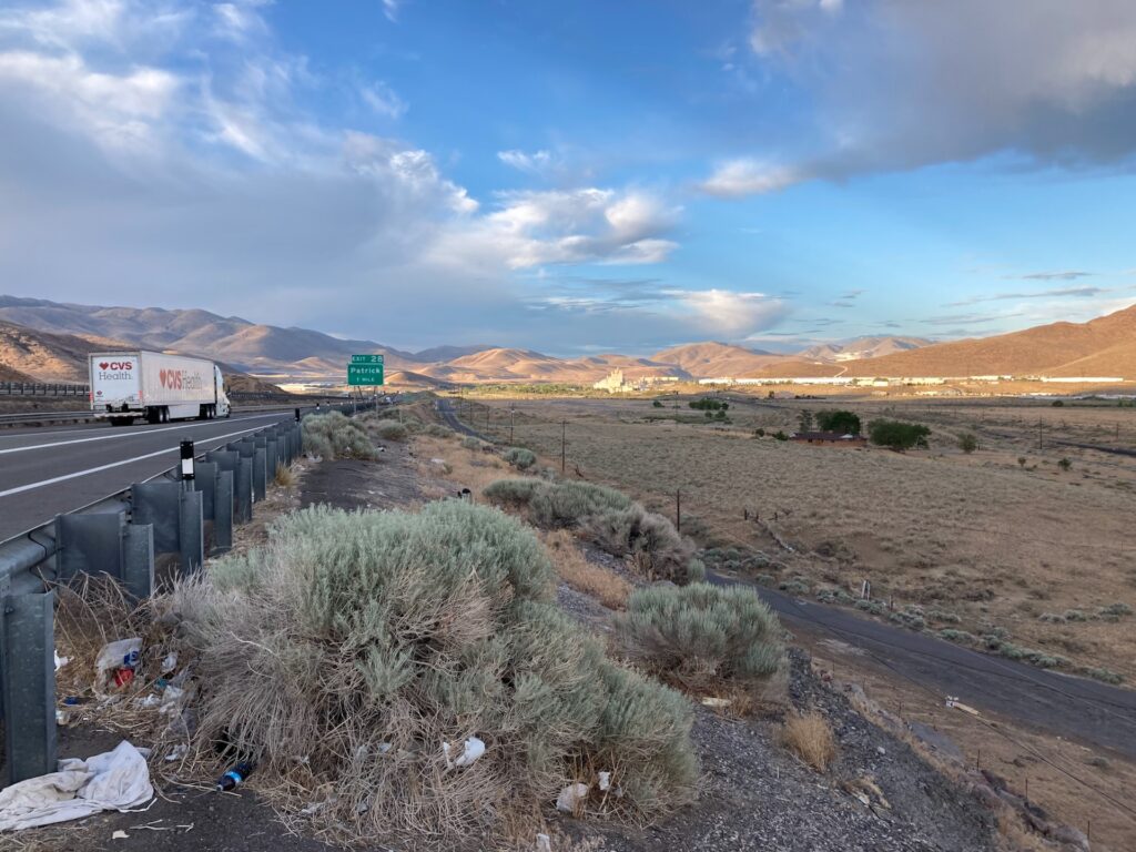
That sublime Nevada landscape is completely surveyed, marked out with roads and power lines, dotted with trash and effluvia; the habitats of plants and territories of birds must fit into the interstices of that human framework.

We drove on under the awe-full evening sky, and checked into our motel in Fernley, Nev.

My iNaturalist observations for June 20

Two Oaks to Coe State Park HQ via Poverty Flats

At 5 a.m., I got up to make breakfast. The temperature was about 45 degrees — cool enough for a sweater, a jacket, and a warm hat. After eating breakfast and packing up, I spent some time looking at the huge mistletoes growing on a nearby oak tree. Two of them must have been more than fifteen feet long, huge dark masses hanging among the branches of the oak.

I started hiking at 6:25, climbing up and then turning right to hike down the Middle Ridge Trail. In about three quarters of an hour, I passed the junction with Fish Trail, then went up a little knob through a stand of Bigberry Manzanita (Arctostaphylos glauca). The dramatic contrast between the rich green leaves and dark-red twisted trunks of the manzanitas was quite beautiful. More visual drama was to come. As the trail wound down Middle Ridge, every so often I’d catch sight of a huge bank of white fog filling the valleys beyond Poverty Flats.

Fog in the distance from Middle Ridge Trail, Coe State Park

Walking through such a landscape didn’t leave much room for other thoughts, which was fine with me. I looked at flowers, and walked, and that’s about it.

At about twenty past eight, suddenly I heard the sound of running water, and then rounding a bend I could see the Middle Fork of Coyote Creek. After crossing the creek, I dropped my pack, and spent half an hour resting. An Anna’s Hummingbird buzzed close to my head, and lots of other birds were singing in the brush along the water. A female Wood Duck was startled when I walked too close to her, and flew low along the water to another hiding place.

Middle Fork of Coyote Creek, looking back up at the Middle Ridge Trail

Poverty Flats Road climbs fairly steeply up from Coyote Creek, rising about 800 feet in a mile and a half. I took my time, pausing frequently to look at flowers, or to admire the view of Middle Ridge across the valley of the Little Fork of Coyote Creek. A couple of state park trucks drove down the road; those were the only two people I saw for most of the morning. Then once I got to the junction of Forest Trail and Corral Trail, at about 11:45, I passed several groups of people — dayhikers and backpackers starting the Memorial Day weekend early.

At ten past noon, I arrived back at park headquarters. While I ate my lunch, I talked with one of the park rangers. Then it was time to head home before the Memorial Day traffic got bad. And as I drove north up Highway 101 to San Jose, I could see that it was already stop-and-go traffic headed south.

Coe State Park HQ to Two Oaks

Coe State Park is a magical place, and I decided to return there one last time before we move to Massachusetts. I left the park headquarters at 11:50 a.m., and began hiking up Monument Trail. It was slow going with a full pack, but even at my slow pace I overtook an amateur herpetologist who showed my a Southern Alligator Lizard he was photographing. Naturalists walk even more slowly than old backpackers.

Southern Alligator Lizard

After four-tenths of a mile, I turned onto Hobbs Road. As I passed the Frog Lake campsite, I stopped for a moment to talk with a parent and child who were just setting up camp there. I asked the child if they enjoyed Frog Lake, and they told me they liked throwing rocks at the sunfish to “bonk them on the head.” I explained that the Bluegills were probably close to shore guarding nesting sites, and that it wasn’t a good idea to throw rocks at them when they were trying to raise the next generation of fish. The child was not fully convinced, but their parent, sotto voce, thanked me for reinforcing that message.

I climbed up to Middle Ridge Trail, for a total elevation gain of 800 feet in about 2 miles, turned right on the Middle Ridge Trail, and walked down to the Two Oaks campsite. I laid out my ground cloth and sleeping bag, emptied my pack of everything except food and water, then went back up to Hobbs Road. As I walked down the switchbacks of Hobbs Road, I admired the view of Blue Ridge rising steeply up on the other side of the Middle Fork of Coyote Creek.

Blue Ridge, as seen from Hobbs Road, Coe State Park

Although it’s late in the season, there were still quite a few flowers in bloom. Patches of Elegant Clarkia (Clarkia unguiculata) made a faint pink wash on some steep hillsides. Yellow Mariposa Lily (Calochortus luteus), Butterfly Mariposa Lily (Calochortus venustus), and Globe Lily (Calochortus albus) stood out in the dry brown grasses. Dramatic white clusters of flowers covered California Buckeye trees (Aesculus californica). I had hoped to hike all the way down to Coyote Creek, but it was getting late and my legs were tired. Discretion being the better part of valor, about two thirds of the way to the creek I decided to turn around.

Back at the campsite, I could hear Wild Turkeys gobbling up the hillside above, and down towards Frog Lake. One got louder and louder, and a big tom walked within 50 feet of the campsite, stalking angrily along, presumably looking for a rival to confront. I made dinner, walked down to Pajahuello Spring to fill up my water bottles, and then sat and enjoyed the evening. I was in my sleeping bag before dark. I awoke later in the evening to see the Big Dipper overhead, but fell back asleep almost immediately.

Field trip

We went for a hike in Henry W. Coe State Park today. There were still quite a few flowers in bloom, of which my favorite was the Butterfly Mariposa Lily:

Butterfly Mariposa Lily

The terrain was the usual steep hillsides of the Coastal Ranges:

Carol on the trail heading back from Frog Lake

The weather was ideal: 65-75 degrees, with a steady northerly breeze. We walked about 8-3/4 miles with 1360 total elevation gain, enough of a workout to make it seem worth while, but we took it slow so we didn’t get burned out. Just about a perfect day.

The obligatory Ano Nuevo State Park Elephant Seal photo

On my way home from a ministers’ retreat this afternoon, I stopped at Ano Nuevo State Park. The reason most people visit the park is to view the Elephant Seals that live there. And what’s not to like about these charismatic megafauna?

Molting female Elephant Seal

Today’s visit was too short. I’ve already convinced Carol to accompany back to the park tomorrow. (Although, to be completely honest, my primary motivation is seeing the nesting Bank Swallows I didn’t have time for today. Don’t tell Carol.)